
(CLOSED) Harrow to Pinner Cycleway Improvement Scheme
Consultation has concluded
Welcome to the Harrow to Pinner Cycleway Improvement Scheme engagement page.
London Borough of Harrow's engagement on our proposals for improvements for walking and cycling between Harrow town centre and Pinner will run for six weeks from 31st October to 23:59 on 11th December 2023. This consultation is now closed.
Introduction
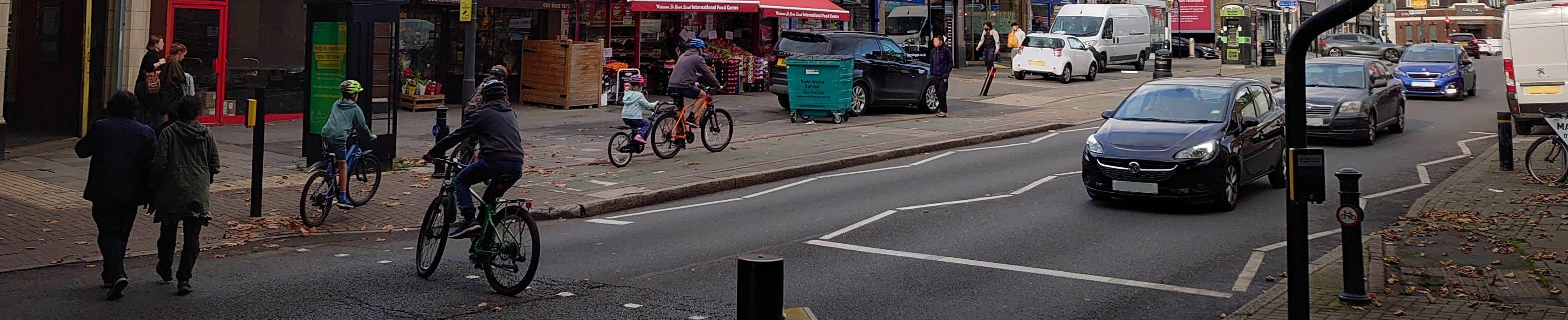
The London Borough of Harrow is seeking to improve choice in how residents travel. This includes making improvements for walking and cycling to key destinations to make it easier, safer, and more enjoyable to walk and cycle. The Harrow to Pinner Cycleway Improvement Scheme represents the first part of developing a Cycleway network across the borough accessible to as many as possible. This route runs from Harrow town centre to Pinner, via West Harrow and North Harrow stations.
We are delivering leaflets to addresses closest to the 3 mile (4.5km) route which provides an overview of the proposals. This on-line engagement page provides a fuller description and detailed plans of the route and further explains the current proposals.
We are seeking your views and suggestions on the improvements. A questionnaire is provided (please click on SURVEY below) for us to understand your views. We will also be running exhibitions including sessions where you can discuss the proposals with officers. More details on these in the Key Dates section (to the right).
The proposals are much more than just a cycle scheme and provide benefits to everyone, especially if you live locally and enjoy getting around your part of Harrow. We are seeking to improve connection from people's homes to some of our key centres and stations. Also improved links to schools, parks, places of worship, bus stops and other local destinations. They include significant public realm improvements and are for everyone who lives, works or studies nearby.
The proposals for the Harrow to Pinner route are broken down into four sections which are outlined in the Documents to the right of this introduction. We hope you like the proposals and see the benefits for all but welcome any feedback. We will consider all the feedback to see if there should be changes to the proposals and in making recommendations to the Portfolio Holder (a senior councillor) who makes decisions on the best way to proceed.
You are welcome to provide feedback on the entire route, or any part of the scheme proposal you are most interested in.
The Harrow to Pinner Cycleway Improvement Route
We have divided the route into four sections so it is easier for people to comment on the sections of the route they are familiar with and use regularly. These are:
Section 2 – North Harrow Centre - Imperial Drive, Station Road and Pinner Road through North Harrow;
Section 4 – Pinner - Marsh Road (from Cecil Road junction through Pinner) and Station Approach.
The sections are also subdivided - an index of these subsections which are referred to in the proposals for each section are at this link. Use of these references in any comments you make will assist us in grouping similar comments together.
Route Overview Map - showing division into four and road names

The main scheme proposals summary
Harrow town centre end: Lighting, signage and environmental improvements in coordination with main town centre project.
West Harrow: Tighter junction geometry, increased pavement areas, new greening features, at several junctions, by West Harrow station and Vaughan School and improved traffic calming to make roads safer and better for pedestrians and cyclist.
North Harrow: New parallel zebra crossing of Imperial Drive, continuous cycle track through North Harrow, relocated bus stop by station and renewed, improved pavements for pedestrian footway areas, tree planting and greening
Pinner: Clear continuous cycle tracks from the proposed 20mph zone in Cecil Park to Station Approach, new public realm scheme outside Jubilee Parade. New or revised parallel zebra crossing across Marsh Road and Station Approach. Renewed, improved pavements, rain garden and other greening.
How to find out more and tell us what you think
There is a description of the proposals in each of the four sections above which you can read by clicking on their link. They are accompanied by plans and illustrations of how the improvements might look. The Frequently Asked Questions (FAQs) to the right provides more background information and explanation of what the various features proposed look like and responses to questions people often ask about similar schemes.
Once you have had a look at the proposals, we really would like to know what you think. We would welcome your feedback on the entire route, or any part of the scheme proposal you are most interested in. Please complete the online survey by following the SURVEY link before 11 December 2023.
If you require further clarification on the proposals or are unable to fill the survey on-line, please email transportation@harrow.gov.uk
You can keep up to date with the project and find other transport related projects at www.harrow.gov.uk/road-maintenance-travel/current-projects-transport-streets
What happens next?
All the responses received will be analysed and presented firstly to the relevant local ward councillors for feedback, and then reported to the Portfolio Holder (PH) (senior councillor) who will make the final decision on how to proceed. Where practical we will make modifications so your feedback can improve the scheme proposals and so it reflects the needs of the local community. We will produce a summary of the results that we will feedback to everyone who took part setting out the results and how they have been used.
It is most likely that any scheme taken forward will need a statutory consultation stage, probably in the early part of 2024, needed to introduce any restrictions covering proposals like parking bays, parking & speed restrictions and traffic calming. This is a further opportunity to make representations about specific proposals. Consideration of the representations is a legal requirement and will take place before a final decision by the PH on an actual scheme to be built.
Documents
-
 Harrow to Pinner Cycleway route - Sections and Plan Numbers (405 KB) (pdf)
-
Harrow to Pinner Cycleway Sections Index.docx (15.2 KB) (docx)
-
Proposals Section 1 - from Junction Road, Harrow, Vaughan Road, The Gardens and Blenheim Road, North Harrow (5.8 MB) (pdf)
-
Proposals Section 2 - North Harrow centre (Imperial Drive, Station Road and Pinner Road (3.01 MB) (pdf)
-
Proposals Section 3 - Woodlands, North Harrow to Cecil Park, Pinner (7.58 MB) (pdf)
-
Proposals Section 4 Marsh Road, Pinner from Cecil Park and Station Approach (3.74 MB) (pdf)
-
Visualisation of Vaughan Road-Bouverie Road proposals (26.5 MB) (png)
-
Visualisation of The Gardens-Blenheim Road junction proposals (20.9 MB) (png)
-
Visualisation of Station Road North Harrow near station proposals (32.9 MB) (png)
-
Visualisation of Marsh Road, Pinner by Cecil Park junction proposals (29.4 MB) (png)
-
Visualisation of Marsh Road by junction with Station Approach, Pinner proposals (10.2 MB) (jpg)
-
Harrow to Pinner Cycleway Public Consultation Leaflet FINAL Harrow end version (3.25 MB) (pdf)
-
Harrow to Pinner Cycleway Public Consultation Leaflet FINAL Pinner end version (4.13 MB) (pdf)
-
Consultation Plan 1 - Junction Road, Harrow and Roxborough Bridge (719 KB) (pdf)
-
Consultation Plan 2 - Roxborough Bridge and Vaughan Road (800 KB) (pdf)
-
Consultation Plan 3 - Vaughan Road, West Harrow (874 KB) (pdf)
-
Consultation Plan 4 Vaughan Road and The Gardens (853 KB) (pdf)
-
Consultation Plan 5 - The Gardens and Blenheim Road (695 KB) (pdf)
-
Consultation Plan 6 - Blenheim Road (east section) (864 KB) (pdf)
-
Consultation Plan 7 - Blenheim Road, North Harrow (560 KB) (pdf)
-
Consultation Plan 8 - Imperial Drive and Blenheim Road, North Harrow (754 KB) (pdf)
-
Consultation Plan 9 - Station Road, North Harrow and station (680 KB) (pdf)
-
Consultation Plans - Imperial Drive & Station Road, North Harrow (plans 8 & 9 combined).pdf (1.16 MB) (pdf)
-
Consultation Plan 10 - Station Road and Pinner Road, North Harrow (663 KB) (pdf)
-
Consultation Plan 11 - Pinner Road, North Harrow and Woodlands (719 KB) (pdf)
-
Consultation Plans - Pinner Road, North Harrow (proposals only plans 10 and 11 combined) (681 KB) (pdf)
-
Consultation Plan 12 - Woodlands (831 KB) (pdf)
-
Consultation Plan 13 - Woodlands, Pinner Road and Melrose Road (1.06 MB) (pdf)
-
Consultation Plan 14 - Melrose Road and Kingsley Road (788 KB) (pdf)
-
Consultation Plan 15 - Marsh Road, Cecil Park and railway bridge (1.34 MB) (pdf)
-
Consultation Plan 16 - Cecil Park, Pinner (986 KB) (pdf)
-
Consultation Plan 17 - Marsh Road and Cecil Park, Pinner (1.38 MB) (pdf)
-
Consultation Plan 18 - Marsh Road and Station Approach, Pinner (1.13 MB) (pdf)
-
Consultation Plans - Marsh Road, Pinner (Plans 17 and 18 combined).pdf (1.76 MB) (pdf)
