
FAQs
- Enhancing the cycle route between Harrow and Pinner through West Harrow and North Harrow centres
- Improving pedestrian and cycle connections to local destinations;
- Enabling more walking and cycling for short trips through better provision and access;
- Increase biodiversity and reduce risk of flooding through the introduction of planting and sustainable urban drainage;
- Reducing the risk of personal injury collisions by the reduction in vehicle speeds; and
- Supporting the local economy through providing more attractive, better laid out and larger public spaces, encouraging people to spend more time in our local centres, driving additional retail spend, benefiting local businesses and their customers
What is a Public Consultation and what is it intended for?
The public consultation on the Harrow to Pinner Cycleway Improvement scheme is to advise people of the proposals and to seek their views on these proposals. It is the first opportunity for local people in general to see and comment on the proposals. We will review the feedback before advising the Portfolio Holder.
What are the main objectives of the proposals?
The proposals have been developed with the aims of:
How has the Council decided on where the routes should go and selected Harrow to Pinner as the first route?
Transport for London (TfL), which is providing the funding to improve the cycling infrastructure across London has provided an outline network of prioritised routes through their Strategic Cycling Analysis (SCA). This rough cycle network suggests links between major destinations where cycle demand is currently high and expected to increase in the future within the borough and to destinations beyond. In addition, the council has aspirations to link other communities. The aim is to achieve a network of route within easy reach of as many people’s homes as possible, linking to key local destinations. We do not have any Cycleways in the borough at present, but the target is to get 40% of homes within 400m of a Cycleway by 2030. London Borough of Harrow and TfL have selected two routes with some existing infrastructure but have some barriers. These are Harrow to Pinner and Northolt Park to North Harrow. These are on the London-wide Strategic Cycling Analysis (SCA) map. Together, once complete, they place 16% of the urban are of the borough within 400m of a Cycleway.
Is the Harrow to Pinner route a one off?
No. It is the first scheme specifically designed to Cycleway standards but there have been parts of other recent routes which are a similar standard and there are several other routes being planned to enable as many homes to be within 400m (1/4 mile) of a route leading to key local destinations.
We want to make is easier and more enjoyable to walk and cycle in Harrow. That’s why we’ve worked with TfL to identify routes that can be improved that will provide connections between and into town centres in the borough, to public transport interchanges and connect to neighbouring boroughs active travel networks.
There are two routes that are under development at the moment. They are an improved walking and cycling route between Harrow Town Centre and Pinner and phase 1 of a north-south route between Northolt Park and Rayners Lane. Details of proposals and progress to date can be found using the links on this page.
Once the improvements planned are implemented the routes will be suitable for inclusion in Transport for London’s Cycleway network. Cycleways are a pan-London network of high-quality walking and cycling network.
The proposals will deliver high-quality low traffic, active travel routes that will enable local people to make more local trips by walking and cycling.
What are the significant public realm improvements proposed as part of this scheme?
The most significant public realm improvements are:
along Station Road, North Harrow where it is proposed to - widen the footway (pavement) near the station and repave in consistent new materials; declutter and remove or relocate phone boxes and similar; reposition the Wealdstone (north) bound bus stop onto a new bus stop island the other side of the station entrance; provide clearer defined spaces for pedestrian and cyclist areas; and other measures like tree planting and a rain garden for a greener and sustainable environment.
and along Marsh Road, Pinner where Jubilee Parade fronting 137 to 183 Marsh Road is being changed from a service road into a pedestrian and cycle space away from traffic with wider footway and opportunities outside the shops & restaurants along with tree planting and greening along Marsh Road generally.
however there several other significant interventions along the route as illustrated by the pictorial views of Blenheim Road / The Gardens junction by Vaughan School, and Vaughan Road / Bouverie Road junction and Marsh Road / Station Approach junction.
What are the distances and journey times for the various sections of route?
Distances and journey times
| Harrow Town Centre | West Harrow | North Harrow | Pinner |
Harrow Town Centre |
| 1.15 kms 7 mins cycle, 13 min walk | 2.2 kms 12 min cycle, 28 min walk | 4.5/2.8 miles 21 min cycle 55 min walk |
West Harrow | 1.15 kms 7 mins cycle, 13 min walk |
| 1 km 0.7 miles 5 min cycle 14 min walk | 3.35/2.1 miles 13 min cycle 42 min walk |
North Harrow | 2.2 kms 12 min cycle, 28 min walk | 1 km 0.7 miles 5 min cycle 14 min walk |
| 2.3 kms 1.4 miles 9 min cycle 28 min walk |
Pinner | 4.5kms/ 2.8 miles 21 min cycle 55 min walk | 3.35kms /2.1 miles 14 min cycle 42 min walk | 2.3 kms 1.4 miles 9 min cycle 28 min walk |
|
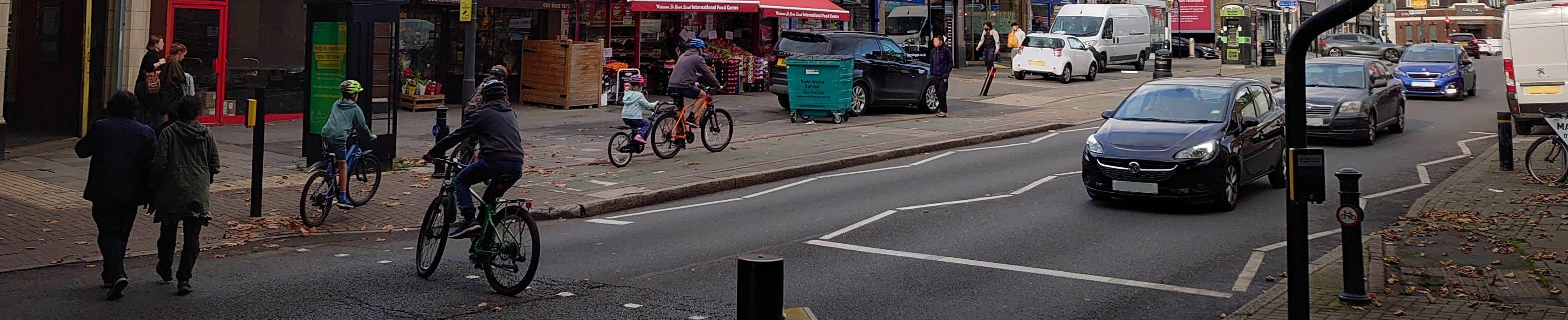
What is a Cycleway and how does it differ from existing cycle measures in Harrow?
Cycleways are high-quality cycle routes that link communities, businesses and destinations across London. They're easy to navigate so riders of all levels can feel safe and confident. They differ from much of Harrow’s existing infrastructure in that they are end to end routes which are consistent with no gaps at awkward sections which can produce barriers to people cycling and walking. Cyclist are protected from busy and fast-moving traffic unlike the many advisory cycle lanes. This type of route has succeeded, across many parts of London, in attracting more people of all ages to take up cycling. In Harrow some parts of our routes are quite close to Cycleway standard but often there are then difficult sections. The underlying aim is to create or improve routes to help people to cycle and walk for appropriate journeys without making it more difficult for other road users so there is a win-win for all residents.
Does introducing a Cycleway make it more difficult for other road users?
No, except perhaps for people seeking to go though residential streets at speed. Although some places where motorists can currently park may be lost, the aim of the proposals is for no net loss in parking. So we have sought out different places to parkas local any removed parking as possible. For instance we propose to remove some of the median strip entry treatments in North Harrow on some the quieter side roads to enable replacement parking to be located in these accessible locations.
Whilst providing a higher level of provision for people walking and cycling, we are also providing benefits to other road users. Wherever feasible we are improving road safety for all. This includes through the introduction of speed reduction measures such as traffic calming, 20 mph speed limits and shorter crossing distances where people cross at junctions. Raised entry treatments at junctions will also permit easier crossing for pedestrians at side roads as slopes are removed, of particular benefit to the physically impaired and those with buggies and wheelchair users.
Bus users will benefit from improved connectivity to bus stops and improved bus stop facilities.
These improvements will in turn bring health benefits, reduce motor traffic, and bring associated improvements in air quality. In addition, proposals for on-road sections will include junction upgrades to make them safer for everyone provide safer crossings for people walking and cycling.
As so few people cycle in the borough why are you bothering to spend so much money and time on creating Cycleway route?
It is true that the borough has some of the lowest numbers of people cycling and percentage of journeys being completed by bike. This may partially be as Harrow is in outer London but some other outer London boroughs have much higher cycle numbers.
One of the main reasons people give for why they do not currently cycle is concern about road traffic. In the past we have created routes which at least in part go alongside busy roads or go through busy junctions or cross busy roads. It is recognised this can be intimidating, so Transport for London (TfL) and London Borough of Harrow have been working at developing routes which connect people with key local destinations using routes where cyclists are using quieter streets or are protected from busy of fast moving traffic. These Cycleway standard routes are built to a higher standard from end to end reaching key destinations and are underpinned by a robust quality criteria This means if a cycle route receives Cycleway status users of all abilities and ages in the Borough and across London know it meets or exceeds a standard which will encourage cycling for all. Link here: http://planning.data.tfl.gov.uk/cycle-route-quality-criteria-technical-note-v1.pdf.
In order to meet Cycleway standard, this sometimes means revisiting existing routes to remove barriers to cycling. In so doing we also use the opportunity to make the environment better for those walking as well.
The Cycleway programme is funded by TfL to encourage people to cycle for appropriate journeys which are perhaps too far to walk or are part of journey involving public transport. They are an active, healthy, sustainable option to save having a car for local journeys.
What is the council's approach to encouraging walking and cycling?
National government, in London and at borough level are concerned about issues like climate change, congestion, road danger and low levels of physical activity on many people leading to poorer health. There is therefore significant investment to encourage people to look at alternatives to the private car and into getting more exercise.
Providing people realistic options to walk or cycle for some local journeys achieves that and makes it easier for those using public transport to get to a bus stop or Underground station.
The London Borough of Harrow, working with Transport for London has developed a series of proposals to improve walking and cycling connections to town centres, transport hubs, parks and schools, for people walking, cycling and wheeling. The individual proposals provide vital missing connections or improve on what is there already. Combined together they provide a high-quality end to end connection between town centres in the borough.
The proposed improvements to crossings are improvements for anyone walking, cycling or wheeling. At locations along the way the proposals also provide improvements to town centres and the public realm, including more space for people, seating, tree planting and sustainable urban drainage where flooding is sometimes a problem.
What sort of design features would you introduce when developing a Cycleway route?
Some improvements are standard infrastructure improvements that are widely seen throughout the country. They have been included in scheme proposals as they benefit all road users but particularly make streets safer, particularly for walking, cycling and wheeling planned in Harrow.
These are not only used on Cycleway routes but they include types of crossings, speed management features, junction designs and landscaping that reduces the risk of flooding. These features, that provide benefits for everyone and are outlined in the following FAQs.
What are the various types of cycle track proposed?
Cycle tracks are proposed either within the existing footway (area beside the carriageway) or an expanded footway area. These are mainly proposed beside the main roads in order to provide protected space for cyclists, physically separated from the main traffic.
There is an existing two-way cycle track along part of Station Road and Pinner Road in North Harrow. It is proposed to improve and extend this track allowing cyclist to travel in both direction from the proposed new parallel zebra crossing across Imperial Drive through the Station Road / Pinner Road junction to the closed junction with Woodlands.
There is a similar proposed new two way cycle track as part of the Jubilee Parade public realm improvements.
Elsewhere along both sides of Marsh Road, Pinner between its junction with Cecil Park and Station Approach unidirectional cycle tracks are proposed. Much of this is by a stepped track where the cycle track is stepped down from the existing footway but there is a further step down to the carriageway. Cycling is only allowed in one direction , adjacent to traffic flow travelling in the same direction.
What are sinusoidal speed humps?
Speed humps are good for reducing traffic speeds on quieter roads. ‘Sinusoidal’ speed humps are generally spaced every 100 metres and are designed to be comfortable if driven over at an appropriate speed and are considerate to cyclists. They are effective at reducing traffic speeds because they cover the full width of a road but can cause issues for emergency service and if on bus routes.

What are the widths of the cycle tracks proposed?
The majority of two-way cycle tracks proposed are 2.5m (just over 8 feet). this is the general recommended minimum width for cycle track and allow two cyclists to pass each other comfortably. For short sections this is reduced to 2m (about 6 feet) where the space on the footway is restricted and past the bus stop islands. This also helps to lower cycling speeds along with the mini-zebras proposed. These mini zebras operate in a similar way - that cyclists must give way to pedestrians crossing as for traffic and pedestrians on normal zebra crossings.
There is a 3m wide two-way cycle track proposed outside Jubilee Parade, Marsh Road, Pinner.
There are also cycle tracks which operate in one direction only along Marsh Road in Pinner. These are either fully on the footway or on stepped tracks still classed as footway but at a level between the main footway and the road.
What is proposed at junctions with side roads along the route?
The road space at some junctions in Harrow are very wide compared to the rest of the street they are used to access. This makes it harder and more dangerous for pedestrians to cross side roads and makes the junctions more dangerous for all road users. We are therefore proposing junction narrowing in places where it makes sense to do so.
Along the active travel routes we are also making crossings over side roads step free so they are easier for people walking, wheeling prams, using wheelchairs or mobility scooters. We are also taking the opportunity to introduce more trees and small areas of planting where space is created by making the safety improvements described.
What is a parallel zebra crossing and where are they proposed?
Parallel crossings are a fairly new type of Zebra crossing which also enable people cycling to use them, in a defined separate space alongside space for people walking. The same rules apply when using the crossings as normal zebra crossings meaning people crossing have priority over those using motor vehicles. The improved crossing provision means both pedestrians and cyclists can cross safer and more easily.
Picture
Parallel zebra crossings or parallel crossings are proposed across:
a) Imperial Drive, North Harrow between the junctions with Blenheim Road and Argyle Road (new crossing);
b) a modification to the existing parallel crossing of Marsh Road, Pinner near the bridge over the railway;
c) a modification to the existing parallel crossing of Marsh Road, Pinner near the junction at the western end of Cecil Park;
d) Marsh Road, Pinner between the park entrance and the bridge where Marsh Road passes under the railway (new crossing);
e) Marsh Road, Pinner just north of the junction with Station Approach (repositioned and upgraded crossing); and
f) Station Approach, Pinner close to its junction with Marsh Road
What is Sustainable Urban Drainage and rain gardens?
Sustainable urban drainage is the term used to describe areas of planting that are designed to absorb runoff, particularly reduce the negative impacts of flooding from heavy rain. Sometimes called rain gardens, these areas are proposed in locations susceptible to flooding and where other proposals create new spaces to enable the creation of new planting areas. Any planting is quite low level if near junctions or bends so visibility of traffic, pedestrians etc is not restricted.
Picture
How were the design proposals decided? Was there much fieldwork done? Have you spoken to local people?
The design proposals followed careful examination of the existing “Metropolitan route” between Harrow town centre and Marsh Road in Pinner. There was a need to reach further into Pinner, the station being identified as a realistic target, at one end. At the other there was an interface with the Future High Streets Fund project so the route finished in Junction Road. The desire in the future would be to potentially reach Harrow on the Hill station and reach further into Pinner.
For the borough’s first full Cycleway project we have chosen to build upon what was already present but make significant but hopefully realistic improvements to remove barriers and produce a quality route. A route which in time will link with others across the borough and beyond as part of a London-wide Cycleway network.
Along the existing route there were quite a number of opportunities for improvement to enable the route to reach TfL Cycleway criteria and be both practical and attractive for cycling. The investigation and design work was carried out by specialist design consultants with many years of experience delivering successful schemes in inner, outer London and outside London.
A significant amount of survey work was carried out both in terms of measuring traffic, pedestrian and cycle volumes also the physical geometry of the roads. We also look to contact and find the needs of local stakeholders including local schools and businesses. This however is an ongoing process and has now been expanded to this general public consultation.
Where does the funding for these proposals come from? Can it be used for my and other people’s priorities?
The funding for developing the proposals, consultation and implementing any changes is all funded by Transport for London’s Cycling programme funding. This may well include repaving of footway areas to benefit pedestrians, not just those areas used by cyclists.
This funding for implementation is dependent on a viable scheme to raise the quality of a continuous route to recognised Cycleway standards being created, not just sections which are easier to deliver. This does not require the exact design in the consultation to be delivered as there may be change as a result of consultation but piecemeal bits of routes would not be an acceptable scheme.
Nor can Cycleway funding be used on other things irrespective of how urgent those other things, like pothole repair, might be.
What are we doing, and will we be doing with the responses we receive?
We have noted responses and comments as the consultation proceeds and have added to the Frequently Asked questions where clarification or further information is thought helpful.
At the end of the consultation period all the responses and other communications will be analysed. All aspects of the route proposals will be reviewed in the light of the feedback received and discussed with ward councillor and a report produced explaining the response to the consultation and recommending what changes should be made to the proposals. This report is considered by the Portfolio Holder who is the decision maker in what proposals go on to the next stage.
It is likely that there would then be a statutory consultation which is a legal requirement if any restrictions or speed limits are to be introduced or changed. This allows anyone to raise formal objections to the restriction proposals which must be considered before they can be introduced. There would be a further report and decision made at that stage.
Can you just put in proposals which enjoy strong support from people?
The consultation is an opportunity to advise and explain to people of what is proposed and to listen to the response people give. The Cycleway funding is for delivery of a whole cycle route not completion of bits which enjoy strong support leaving gaps where it is more difficult. The consultation is thus not a referendum one each aspect or a means of picking from a menu. Having said that, proposals which receive opposition will be seriously considered whether they are essential to deliver the route and/or if modifications can be made to address specific concerns.
What if there are particular proposals that people dislike or have concerns about?
Our design consultant is experienced in designing such schemes providing a balance of proposals to improve opportunities for walking and cycling but mindful of all transport and community needs. Care has been taken to assess local conditions and various options were considered before the design for consultation was resolved. This design aims to provide for a cycleway to established standards which was not straightforward at some locations due to other competing needs.
Part of the design review process follow the consultation will be to see if the objectives of creating a continuous quality route can be achieved without the proposal attracting significant negative response or whether some modification would help address the concern. This consideration of options will form part of the report to Portfolio Holder.
Are the proposals subject to an independent safety review?
Yes. The proposals have been subject to review by independent safety auditors. This in addition to review but various parts of TfL regarding issues including Healthy Streets, traffic flow and bus services.
What are the proposals for the forecourt areas in North Harrow?
At present there is a wide area in front of the shops know as forecourts. Despite appearing the same along Station Road between the station and Cambridge Road the ownership and responsibility varies considerably. In most instances most or all the width is public highway as with the paved area in front but some of the shops (usually the freeholder) have ownership, responsibilities and right over their private forecourts.
At present the pavement in front of the shops looks dated, uncoordinated and rather unattractive. The proposal is to repave the full area on coordinated paving. We can do this with the public highway section but also can be done for the private forecourts with the owner’s consent. The largest area near and to the north of station entrance is owned by London Underground (LUL), part of TfL.
The only vehicular access to the forecourt areas is the dropped kerb crossover to LUL forecourt which is intended to enable loading. All other crossing even to reach private forecourts is illegal.
There are also private forecourts where the proposed Cycleway / existing cycle track goes along Pinner Road. These are rather narrower than those in Station Road. It is again, with the forecourt owners’ consent, proposed to repave up to the shop fronts. This important as the remaining width of footway between the forecourts and the proposed widened cycle track is as little as 1.5m in places. There may however be some complicating factors with drainage and levels which may complicate issues. One of the forecourts outside the pub has a substantial step up to get into the building so this will be left unchanged.
What was the extent of the leaflet distribution?
The basic distribution area was all directly affected frontages and properties a short distance from the route in adjoining roads. This area was selected to try to notify those who would be most affected by the proposals. Where there are larger interventions especially in Pinner and North Harrow a slightly wider distribution area was selected.